Reported By: | Edited By: Nidhi Jamwal |Source: DNA |Updated: Jun 29, 2018, 03:10 AM IST
On June 14, the US-based Climate Prediction Centre/NCEP/NWS and the International Research Institute for Climate and Society (CPC/IRI) issued an El Niño Watch warning of “the chance for El Niño increasing to 50% during fall, and 65% during winter 2018-19”. These forecasts, informed the El Niño Watch, were supported by the ongoing build-up of heat within the tropical Pacific Ocean. An El Niño Watch is issued when conditions are favourable for the development of El Niño conditions within the next six months.
Five days later, on June 19, the Bureau of Meteorology, Australia, too, moved to El Niño Watch saying “the likelihood of El Niño forming in 2018 is approximately 50%; double the normal chance.” As per the Bureau, “oceanic indicators are currently neutral — neither El Niño nor La Niña — but show some signs of potential El Niño development”. For instance, sea surface temperatures in the eastern Pacific Ocean have been slowly warming since April. Also, waters below the surface of the tropical Pacific are now warmer than average, which is a common precursor to El Niño. The presence of El Niño can significantly influence weather patterns across large portions of the globe, including India.
El Niño and La Niña are complex weather patterns resulting from variations in ocean temperatures in the Equatorial Pacific. Both are opposite phases — El Niño (warm phase) and La Niña (cold phase) — of the El Niño-Southern Oscillation (ENSO) cycle (third phase is ENSO neutral), which is periodic fluctuation (every 2-7 years) in temperature between the ocean and atmosphere in the east-central Equatorial Pacific.
To monitor ENSO conditions, sea surface temperature (SST) anomalies in four geographic regions of the equatorial Pacific are studied. These four regions are Niño 1+2, Niño 3, Niño 4, and Niño 3.4 (comprising portions of Niño regions 3 and 4). When SST anomalies equal to or greater than 0.5°C in the Niño 3.4 region are observed, they are indicative of El Niño conditions; whereas anomalies less than or equal to minus 0.5°C are associated with La Niña conditions. In order to declare an El Niño, three-month averages of SST anomalies in the Niño 3.4 region should equal or exceed the threshold of 0.5°C five times in succession.
Simply put, during El Niño, there is a warming of the ocean surface (above-average sea surface temperatures) in the central and eastern tropical Pacific Ocean. Also, the low-level surface winds, which normally blow from east to west along the equator (also known as “easterly winds”) weaken or, in some cases, start blowing from west to east (also known as “westerly winds”). El Niño is known to cause reduced rainfall over Indonesia and an increased rainfall over the tropical Pacific Ocean.
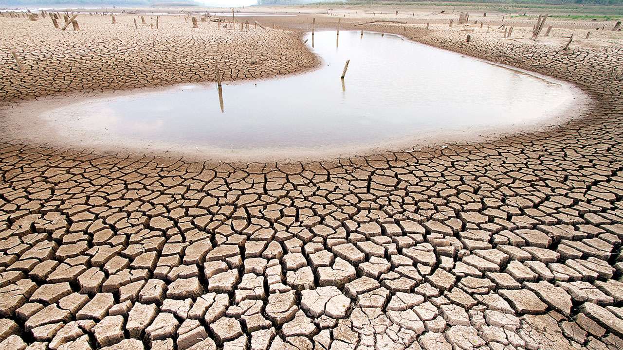
El Niño is a matter of concern for India because it impacts rainfall received as part of the southwest (SW) monsoon. It is claimed that the SW monsoon accounts for 80 per cent of the rainfall in India sustaining agriculture and livelihood of millions of people. A large number of scientific studies associate El Niño with a weak SW monsoon (rainfall below normal), and La Niña with a strong SW monsoon (rainfall more than normal). For instance, a 2013 study, ‘Impact of El Niño/La Niña on Indian summer monsoon rainfall’, plotted monthly mean anomalies of rainfall between 1960 and 2010 in the country, and reported “rainfall is showing an inverse relation with the El Niño years” (with some exception years).
As per the June 2014 Working Paper 276 of Indian Council for Research on International Economic Relations, “looking at the relation between El Niño and Indian droughts since 1950, it is observed that India faced 13 droughts, and 10 of these were in El Niño years and one in a La Niña year.” The paper notes that since 2000, there were four El Niño years (2002, 2004, 2006 and 2009), and three of these (except 2006) resulted in drought years in India.
Scientists and meteorologists in India are keeping a close watch at the present El Niño conditions. According to Dr M Rajeevan, secretary, Union ministry of earth sciences, at present the models suggest possibility of an evolution of a weak to moderate El Niño by end of September this year. But, as of now, no adverse effect of El Niño is anticipated on this year’s SW monsoon.
However, Dr Mihir Kumar Dash, associate professor with Centre for Oceans, Rivers, Atmosphere and Land Science (CORAL) at the Indian Institute of Technology Kharagpur claims that “rainfall over India during September may reduce”. According to him, there are more chances of El Niño Modoki (associated with strong anomalous warming in the central tropical Pacific and cooling in the eastern and western tropical Pacific) this year, which also leads to reduced rainfall over the Indian subcontinent. There will also be reduction in cyclone activities over the Bay of Bengal during post monsoon period. However, as per Dr Dash, the northeast monsoon (October to December) is likely to be strengthened.
Apart from the possible impacts on rainfall in the country, in case the El Niño develops and persists, “we should expect more heat waves during next summer”, warns Dr Rajeevan. The severe heat wave of 2015 (2015 was an El Niño year) is a classic example when more than 2,330 people died in the country.
The writer is an independent journalist based in Mumbai. Views are personal.